



首页 >>
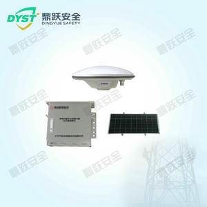
名称:Beidou Online Monitoring Device for Geological Hazards Along Transmission Lines
型号:
I. Requirements Analysis Geological hazards such as landslides and subsidence caused by underground mining activities lead to surface deformation. These surface deformations directly impact the foundations, towers, and spans of high-voltage transmission line structures, further inducing deformation in other components of the transmission lines. Collapses and failures occur frequently, posing severe threats to grid safety. Therefore, it is necessary to establish a Beidou-based online monitoring s
产品详情
I. Requirements Analysis
Geological hazards such as landslides and subsidence caused by underground mining activities lead to surface deformation. These surface deformations directly impact the foundations, towers, and spans of high-voltage transmission line towers, further inducing deformation in other components of the transmission lines. Collapses and failures occur frequently, posing severe threats to grid safety. Therefore, it is necessary to establish a Beidou-based online monitoring system for geological hazards along transmission lines. This system will enable real-time tracking of geological hazard conditions, comprehensively enhancing the management of transmission line towers.
II. Working Principle
The Beidou Geological Hazard Online Monitoring Device for Power Transmission Lines employs millimeter-level or centimeter-level Beidou high-precision relative positioning technology. Relative positioning involves placing two (or more) receivers at opposite ends of one (or multiple) baselines to simultaneously observe the same Beidou satellites, thereby determining the relative positions of baseline endpoints or baseline vectors. During relative positioning, differential processing of observations eliminates satellite clock errors and receiver clock errors, mitigates ionospheric and tropospheric refraction effects, and resolves integer ambiguity parameters, thereby enhancing baseline accuracy. By deploying BeiDou monitoring antennas on towers requiring positioning and integrating data from national BeiDou ground-based augmentation stations, carrier phase data and ephemeris required for processing are transmitted simultaneously to the data center via an encrypted communication network. The data center receives raw real-time data streams from each monitoring point and base station. Utilizing the BeiDou data processing engine, it performs baseline calculations between base stations and positioning points, nbsp; obtaining the tower's high-precision real-time 3D coordinates to monitor its settlement status.
III. Features and Functions
1. Basic Configuration for BeiDou Geological Hazard Monitoring: Master Control Unit, BeiDou Settlement Monitoring Unit, Communication Unit, Power Supply Unit, BeiDou Communication Module, Mounting Bracket, and Auxiliary Materials;
2. Collect high-precision real-time 3D coordinates, base station observation data, monitoring point observation data, as well as ephemeris and precise ephemeris data. Transmit encrypted data via 4G/5G signals to the service platform for processing, then analyze the data using BeiDou ground-based augmentation network resources.
3. BeiDou Receiver Functionality: Includes all equipment encompassing data acquisition, centralized transmission, processing and calculation, display and recording, as well as safety protection facilities such as lightning protection and anti-theft measures. This enables the transmission of monitoring data to the monitoring center for display.
4. Unattended Monitoring System: Achieves an annual operational reliability rate exceeding 99%, ensuring 24/7 continuous and reliable operation. The system maintains uninterrupted, fault-free operation for over 100,000 hours.
5. Real-time display and analysis of deformation data, enabling intermittent health status assessments;
6. Central software performs automatic calculations: with a minimum response time ranging from minutes to hours, it conducts real-time network adjustment, automatically evaluates monitoring results, and allows users to fully customize all parameters according to specific monitoring requirements.
7. Diverse daily channel alerts: Alerts are delivered via web, app notifications, and SMS messages, ensuring you stay informed about power tower deformation status anytime, anywhere.
8. Continuously monitor the spatial displacement of deformation points on power transmission towers to determine the deformation status and geometric alignment of the affected zones.
9. Provides high-quality dual-frequency BeiDou measurement data, delivering real-time millimeter-level positioning accuracy. Static accuracy specifications: Horizontal: <±2mm + 0.5ppm; Vertical: <±4mm + 0.5ppm. Real-time monitoring accuracy during wind-induced vibration on power transmission towers: Horizontal: <±10mm; Vertical: <±20mm.
10. Automatically generate reports with customizable reporting cycles (e.g., weekly, daily). Users can freely add or remove essential output information. Additionally, weekly or monthly trend curves for specific data points can be automatically generated as needed.
11. The system employs a modular design with standardized, integrated components to facilitate on-site installation and maintenance.
IV. Product Specifications
Serial Number | Category | Project Name | Technical Specifications |
1 | Overall Performance | Complete System Configuration | Main Control Unit, BeiDou Settlement Monitoring Unit, Communication Unit, Power Supply Unit, BeiDou Communication Module, Mounting Bracket, and Auxiliary Materials |
Overall quality | Total weight: Less than 40 kg (including solar panels and mounting brackets) | ||
Material | Stainless steel body + hot-dip galvanized bracket | ||
2 | Beidou Settlement Monitoring Unit | Observation frequency | Receives signals from multiple navigation satellite systems: BDS (B1/B2), GPS (L1/L2) |
Measurement Accuracy | Horizontal accuracy: ±2.5 mm + 0.5 ppm; Vertical accuracy: ±5 mm + 0.5 ppm | ||
Signal Reception Sensitivity | Less than or equal to -133 dBm | ||
Power supply | Power Input Port | ||
Antenna | 1 GNSS antenna interface, socket type TNC | ||
Remote Control | Supports remote upgrades, remote reset, and remote parameter configuration. | ||
Number of BeiDou modules | Supports up to 4 | ||
3 | Beidou Antenna Unit | Signal Tracking | Capable of receiving GPS satellite signals L1, L2, and L5; GLONASS satellite signals L1 and L2; BeiDou satellite signals. Signal Tracking: B1, B2, B3 Signals, Galileo Satellite Signals |
Phase Center Indicator | A set of communication interface outputs, available in RS232 (default) or TTL level configurations. | ||
Antenna Beam | Azimuth: 0° to 360°, Elevation: 5° to 90° | ||
Axle ratio | 2 dB (elevation angle 90°) ≤ 4 dB (elevation angle 20°–90°) | ||
Voltage Standing Wave Ratio | ≤1.5 (50Ω) | ||
4 | Communication Unit | Communication method | All-network 4G/5G/WiFi/Beidou communication module/wireless transmission |
Data Security | Communication with the main server can utilize a dedicated VPN channel, with optional encrypted transmission. | ||
Access Protocol | Compatible with monitoring platforms of provincial power companies such as China Southern Power Grid and State Grid | ||
5 | Power Supply Unit | Battery capacity | 100Ah/12V, Lithium Iron Phosphate Battery High Reliability Battery |
Solar panel power | 180W/18V, Monocrystalline Silicon High-Efficiency Solar Panel | ||
Power supply duration | The device can maintain normal operation for 15 days without external power supply. | ||
6 | Other parameters | Overall service life | Over 8 years |
Protection Rating | IP66 |